
Secondary Fieldwork - Leeson House
GCSE Geography
Leeson House offers a wide variety of human and physical fieldwork that cater for all exam boards. Using the work carried out by the students our follow up then looks in detail at the enquiry process and links this to the students fieldwork exam questions.
Swanage Bay and Studland Bay
Physical Fieldwork
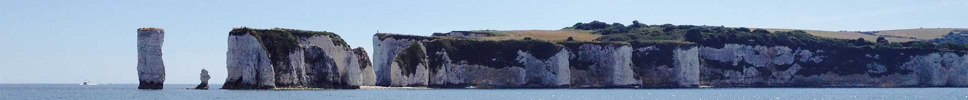
The stretch of discordant coastline from Studland Bay to Swanage Bay is a fine example of a UK coastal landscape and includes major landforms of erosion and deposition. The sand dune system at Studland Bay has been formed by the continuing process of coastal deposition, whereas Swanage Bay contains excellent examples of coastal erosional processes and different types of mass movement.
Lying between the two bays are the headland of Ballard Down and the “classic” Old Harry Rocks. These areas give students the opportunity to study the influence that geology has on the formation of particular coastal landforms at different scales, such as headlands, bays, caves, arches, stacks, etc.
There are many opportunities for both qualitative and quantitative fieldwork at Studland and Swanage, examining different coastal management schemes. Students can look at the managed retreat used at Studland and the resulting conflicts this can cause, as well as the soft and hard engineering used at Swanage to ‘Hold the Line’.
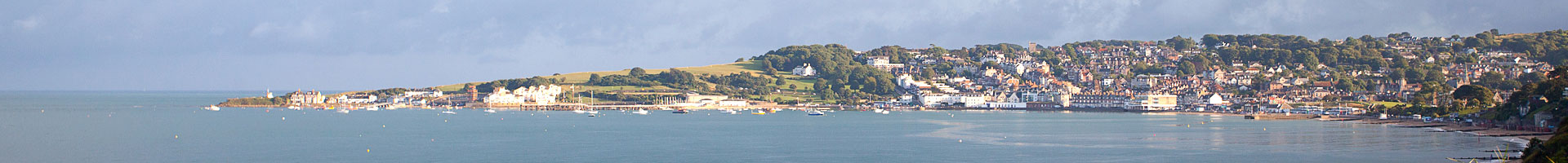
Swanage Town
Human Fieldwork
Swanage Town has a population of approximately 10,000 inhabitants and has undergone economic change over the last 150 years. The economy was built on agriculture and quarrying, however over the past 100 years there has been a steady growth in tourism and currently Swanage relies on these tourists for the majority of its financial growth. There are opportunities in Swanage Town to carry out both qualitative and quantitative fieldwork looking at opportunities and challenges of urban change.
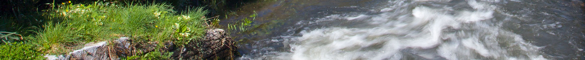
River Piddle or West Corfe River
Physical Fieldwork
Local rivers provide both qualitative and quantitative opportunities to examine how distinctive river landforms are created and how these landforms and river characteristics change downstream. The geomorphic processes involved in the formation of these landforms can also be investigated. These local rivers, plus the nearby River Swanbrook, also provide students the opportunity to examine in detail an example of a UK river basin.
The catchment area of the River Swanbrook includes a variety of the different types of geology and relief, allowing the effects that these factors, as well as precipitation and land use, have on flooding. Since the River Swanbrook flooded in the early 1990s a small flood management scheme has been implemented in the town of Swanage. The river and the management scheme are monitored by the Environment Agency and long-term flow data and hydrographs are available for interpretation.
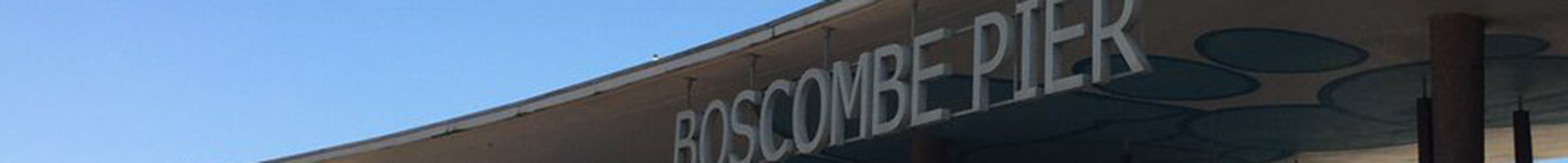
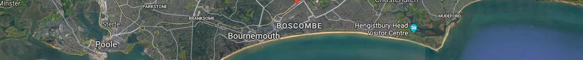
Boscombe
Human Fieldwork
Boscombe is an area in Bournemouth, which provides an excellent example of an urban regeneration project. The area has very high levels of economic and social deprivation linked to the decline in traditional seaside holidays and more recent demographic changes. There are many stakeholders who all work together within the Boscombe Regeneration Partnership. The strategies include seafront rebranding, housing improvements, increasing public engagement and developing heritage / vintage shopping. There are opportunities for students to carry out both qualitative and quantitative fieldwork in different areas of Boscombe.
Poundbury
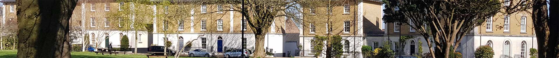
Human Fieldwork
Poundbury is a unique new town with sustainable characteristics designed in part by HRH The Prince of Wales. Old styles of architecture have been cleverly used in Poundbury to create a town unlike anywhere else in the country, however visitors very quickly gain an opinion of the town, whether it be positive or negative. There is an opportunity for a variety of fieldwork techniques to look at the sustainable characteristics of Poundbury along with investigating different people’s opinions of the town.
Boscombe and Queens Park
Human Fieldwork
Boscombe and Queens Park are areas in Bournemouth just a mile apart which have huge inequalities. Boscombe has very high levels of economic and social deprivation linked to the decline in traditional seaside holidays and more recent demographic changes whereas Queens Park is an affluent area with very little deprivation or social issues. There is an opportunity for students to carry out both qualitative and quantitative fieldwork in different areas of Boscombe and Queens Park to identify factors affecting these inequalities in quality of life and standards of living.
Lulworth Cove and Durdle Door
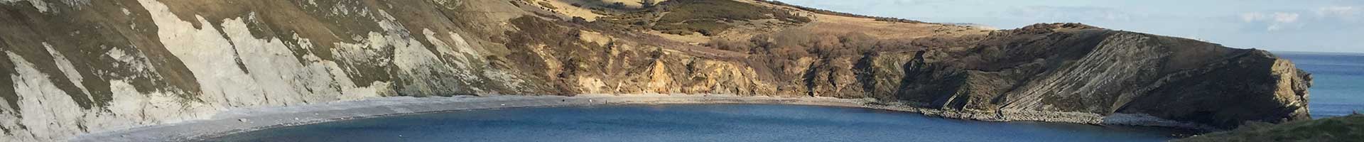
Physical and Human Fieldwork
This stretch of concordant coastline is a fine example of a UK coastal landscape and includes major landforms of erosion and deposition. It is possible to relate the differing landscapes and landforms to sheltering from, and exposure to the prevailing winds and waves from the South West. It has world prominence as one of the best stretches of geological exposures on the planet, telling a 200-million-year story of the history of the Earth. UNESCO have designated it as a World Heritage Site. Due to the natural beauty of the area Lulworth Cove and Durdle Door attract millions of tourists and it is therefore possible to also investigate how a small rural community deal with global tourism along with rural deprivation.
Corfe Castle Village, Worth Matravers, Langton Matravers and Stoborough
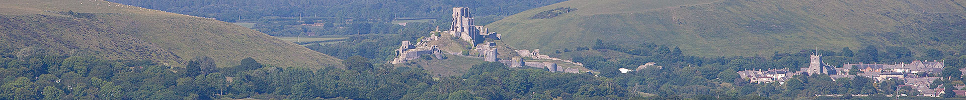
Rural Deprivation | Human Fieldwork
The Isle of Purbeck has a variety of rural villages which all have different factors affecting rural deprivation. From lack of public transport and services to a large proportion of second homes, these villages have very different population dynamics who experience very different problems. There is an opportunity to carry out both qualitative and quantitative fieldwork techniques as well as research secondary data using many GIS based websites.
Our Address:
Leeson House Field Studies Centre
Langton Matravers
Swanage
Dorset
BH19 3EU
Phone: 01929 422126
Email: leesonhouse@dorsetcouncil.gov.uk
Looking for Information on Winter Residentials?
Winter Residential Pages